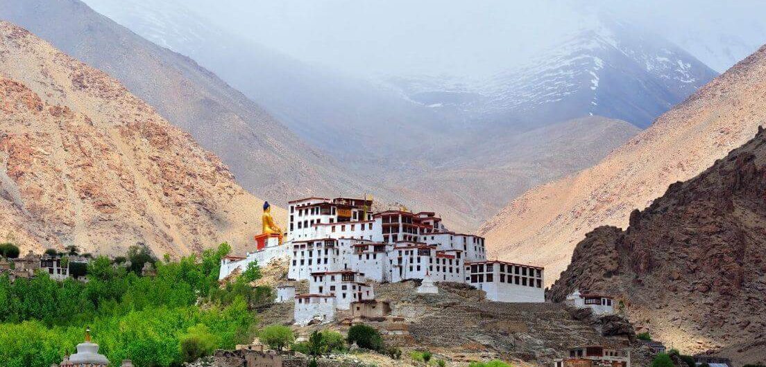
Is Leh Ladakh open to tourists now -- this is one of the most sought questions on the internet as lakhs of tourists who had planned their visit to Ladakh in 2020, 2021 and 2022 were caught up in uncertainty and doubts due to the Covid-19 pandemic; heavy rains coupled with floods and landslides in neighbouring states affected tourist inflow in 2023. The terror attack on tourists in Pahalgam, Kashmir, has also left many tourists scared. Now that 2025 tourist season is about to end but recent protests rocked the "Land of High Passes, tourists are in dilemma about whether they should visit Ladakh or not. Let's clear your doubts. Ladakh Status as on March 20, 2026: Ladakh is open for tourists Updated on March 20, 2026: Ladakh is safe and open for tourists in March. However, as its winter season, the night temperature at many places is dipping as low as minus 5 to minus 20 degrees Celsius. There were reports of some flight cancellations amid snowfall and inclement weather conditions. Mostly all internal roads in Ladakh remain open in winter but sometimes heavy snowfall temporarily blocks roads to Nubra Valley, Pangong Lake, Zanskar and other high altitude areas. The Manali-Leh highway is blocked with snow and is expected to reopen in May. The Srinagar-Leh highway was partially open until early March, but fresh spells of snowfall blocked the road. This is the good time to experience winter in Ladakh. Updated on September 26, 2025: Due to localized civil protests, the Ladakh travel sector is currently navigating a period of unforeseen ambiguity. Tourists presently within Ladakh report that sightseeing operations are proceeding normally. However, those planning upcoming trips or holding future bookings are hesitant to confirm their plans, as the situation remains fluid. While peace prevails on the ground,
Is Leh Ladakh open to tourists now — this is one of the most sought questions on the internet as lakhs of tourists who had planned their visit to Ladakh in 2020, 2021 and 2022 were caught up in uncertainty and doubts due to the Covid-19 pandemic; heavy rains coupled with floods and landslides in
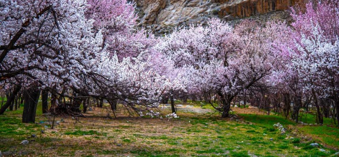
Leh Ladakh — the mystical high-altitude desert in India’s northernmost frontier — is renowned for its rugged mountain panoramas, Buddhist monasteries, and thrilling trekking routes. Yet every spring, this stark landscape transforms into a dreamy canvas of soft pinks, whites, and golden hues when apricot trees burst into blossom. This breathtaking natural spectacle is more than just a visual treat — it is the heart and soul of the Apricot Blossom Festival (Chuli Mendok Festival), a celebration of culture, community, and the fleeting beauty of nature. In this comprehensive travel guide, we’ll explore everything about apricot blossoms in Leh Ladakh — from the best time to visit and where to see them, to the fascinating traditions of the Apricot Blossom Festival and why this annual event is becoming one of India’s most enchanting spring experiences. The Magic of Apricot Blossoms in Leh Ladakh Apricot trees thrive in Leh Ladakh’s extreme climate where winter temperatures plunge well below freezing and summers remain cool. These hardy trees are a lifeline for locals, providing not just fruit but shade, fuelwood, and vital economic sustenance in a region where agriculture is challenging. When spring arrives — usually between late March and early April — the apricot trees awaken from their icy slumber, covering the stark landscapes with delicate flowers. For a few weeks, villages like Stok, Matho, Sakti, Alchi, Dah, Hanu, Skurbuchan, Chuchot, and many other villages glow with color, creating a contrast that enchants photographers, nature lovers, and every traveler lucky enough to witness it. Why are apricot blossoms special in Leh Ladakh? Rare beauty in an arid land: Unlike other blossoms that carpet lush valleys, apricot blossoms bloom in a cold desert — creating a surreal, almost unreal setting. Cultural significance: Apricots are vital to Ladakhi life — the dried fruit (known
Leh Ladakh — the mystical high-altitude desert in India’s northernmost frontier — is renowned for its rugged mountain panoramas, Buddhist monasteries, and thrilling trekking routes. Yet every spring, this stark landscape transforms into a dreamy canvas of soft pinks, whites, and golden hues when apricot trees burst into blossom. This breathtaking natural spectacle is more
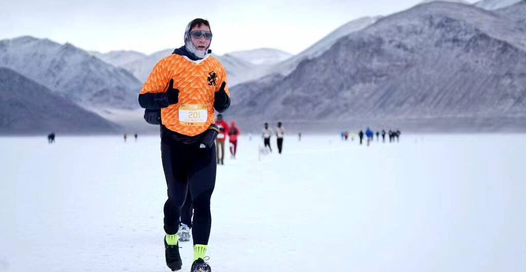
Pangong Frozen Lake Marathon Event Date: February 24 (2026) Address: Pangong Lake, Changthang region. Leh, UT of Ladakh, India Influence: International Event Purpose: To spread awareness about climate change Organizers: Adventure Sports Foundation of Ladakh with the support of Administration of Union Territory of Ladakh, Department of Tourism and Indian Army. The second edition of the Pangong Frozen Lake Marathon -- the world’s highest frozen lake marathon -- was successfully conducted on the icy surface of the Pangong Tso in the Changthang region of Ladakh's Leh district on February 20, 2024. Pangong Frozen Lake Marathon was organised by Adventure Sports Foundation of Ladakh with the support of The Administration of Union Territory of Ladakh, Department of Tourism and 14 Corps, Indian Army. The run was participated by 120 runners from seven different countries in two categories, the 21 km and the 10 km run. Ravinder Kumar, Secretary Sports, UT Ladakh, was the chief guest of the event accompanied by Konchok Stanzin, Councillor from Chushul constituency. The main purpose of organising Pangong Frozen Lake Marathon was to spread awareness about rapid melting Himalayan glaciers, implying this could be the last run on frozen Pangong Lake due to the impact of global warming, at the same time to promote winter tourism in places like Changthang. People from Maan, Merak, Spangmik and Phobrang villages participated in the event along with hosting the runners. They performed various cultural performances during the event. This year Pangong Lake was frozen completely in February after delay of many weeks. Generally, the lake freezes in January. Environmentalists attribute it to the global warming and climate change. Pangong lake freezes completely in winter months. The thick layer of ice on its surface makes it worth walking or running. The Pangong Frozen Lake Marathon is also organised on icy surface
Pangong Frozen Lake Marathon Event Date: February 24 (2026) Address: Pangong Lake, Changthang region. Leh, UT of Ladakh, India Influence: International Event Purpose: To spread awareness about climate change Organizers: Adventure Sports Foundation of Ladakh with the support of Administration of Union Territory of Ladakh, Department of Tourism and Indian Army. The second edition of
Nestled in the western part of Ladakh, close to the Line of Control (LoC), Drass (or Dras) is a small yet historically and geographically significant town located about 60 km west of Kargil and nearly 140 km from Srinagar. Popularly known as the “Gateway to Ladakh” and the second coldest inhabited place in the world, Drass is a destination where natural beauty, heroic history, and raw Himalayan landscapes come together to offer travelers an unforgettable experience. Dras lies in Kargil district of Union Territory of Ladakh. For those travelling from Srinagar to Leh via the iconic Srinagar–Leh Highway (NH1), Drass is the first major settlement of Ladakh and a perfect stopover to acclimatize, explore, and reflect. Why Visit Drass? Drass is not just another mountain town—it is a place that stands as a symbol of resilience, sacrifice, and patriotism. The region gained national and international attention during the 1999 Kargil War, and today, it proudly preserves the memory of the brave soldiers who laid down their lives defending the nation. Beyond its military history, Drass boasts lush green valleys, snow-capped peaks, alpine meadows, clear streams, and traditional Ladakhi villages, making it an ideal destination for nature lovers, photographers, history enthusiasts, and offbeat travelers. Location and Altitude Distance from Kargil: ~60 km Distance from Srinagar: ~140 km Distance from Leh: ~280 km Altitude: Approx. 3,300 metres (10,800 feet) above sea level Due to its high altitude and unique geographical setting, Drass experiences extreme winters, with temperatures often dropping below –30°C, earning it the reputation of being one of the coldest inhabited places on Earth. Best Time to Visit Drass The best time to visit Drass is from May to September, when the Srinagar–Leh highway remains open and the weather is relatively pleasant. Summer (May–September): Ideal for sightseeing, trekking, and travel Winter
Nestled in the western part of Ladakh, close to the Line of Control (LoC), Drass (or Dras) is a small yet historically and geographically significant town located about 60 km west of Kargil and nearly 140 km from Srinagar. Popularly known as the “Gateway to Ladakh” and the second coldest inhabited place in the world,
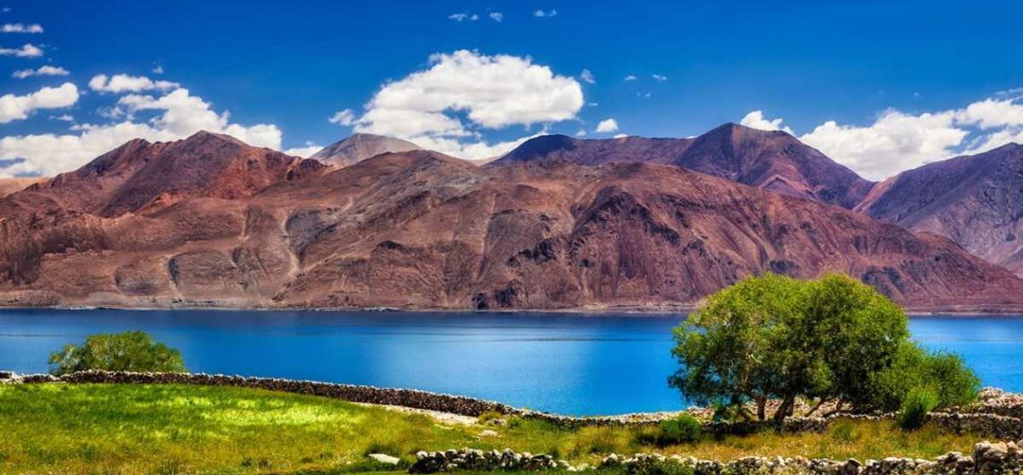
Pangong Lake (Pangong Tso) is one of the most iconic and photographed destinations in Ladakh, famous for its ever-changing shades of blue, dramatic mountain backdrop, and serene high-altitude setting. While most travelers focus on the lake itself, the villages located near the banks of Pangong Lake play a crucial role in shaping the cultural, ecological, and travel experience of this remote region. These villages offer an authentic glimpse into Ladakhi life, Changpa nomadic culture, and sustainable tourism in one of the world’s harshest environments. Staying or visiting these settlements allows travelers to experience Pangong beyond sightseeing—through local food, traditions, and stories. This article explores the main villages near Pangong Lake, their significance, accessibility, and what travelers can expect. Pangong Lake at a Glance Altitude: Approx. 4,225 metres (13,862 ft) Length: Around 134 km (two-thirds lies in Tibet/China) Location: Eastern Ladakh, close to the Indo-China border Best Time to Visit: May to September The Indian side of Pangong Lake is dotted with a few small but culturally rich villages that lie either directly on the banks or very close to the shoreline. Villages Near the Banks of Pangong Lake 1. Spangmik Village The Most Popular Village on Pangong Lake Spangmik village is the most well-known and frequently visited village near Pangong Lake. Located on the north-western bank, it serves as the primary tourist base for visitors. Highlights: Closest village to the most photographed part of Pangong Lake/Shooting Point. Homestays, guesthouses, cottages, and eco-camps available Spangmik village offers stunning sunrise and sunset views Easy access from Leh via Tangtse Spangmik village is ideal for travelers visiting Pangong Lake for the first time. Despite tourism growth, the village retains its traditional Ladakhi charm, with mud-brick houses, prayer flags, and grazing yaks. 2. Man Village A Quieter Alternative to Spangmik Located just a short
Pangong Lake (Pangong Tso) is one of the most iconic and photographed destinations in Ladakh, famous for its ever-changing shades of blue, dramatic mountain backdrop, and serene high-altitude setting. While most travelers focus on the lake itself, the villages located near the banks of Pangong Lake play a crucial role in shaping the cultural, ecological,
High in the remote mountains of eastern Ladakh, close to the India–China border, lies a place that commands silence, respect, and deep emotion—the Rezang La War Memorial (Ahir Dham). Located at an altitude of nearly 16,000 ft at Rezang La pass, the memorial pays tribute to the legendary heroes of the 13 Kumaon Regiment, who fought one of the most heroic last-stands in Indian military history during the 1962 Sino-Indian War.For travelers exploring the rugged beauty and historic landscapes of Ladakh, a visit to Rezang La is not just a sightseeing experience—it is a journey into India’s military legacy, bravery, patriotism, and sacrifice. In this detailed guide, you will discover everything you need to know about Rezang La War Memorial (Ahir Dham), including its history, how to reach, best time to visit, permits, altitude precautions, nearby attractions, and travel tips. What is Rezang La War Memorial (Ahir Dham)? The Rezang La War Memorial is a historic monument built to honor the 113 soldiers of Charlie Company, led by Major Shaitan Singh, who fought the Battle of Rezang La on 18 November 1962. Outnumbered and surrounded, the brave soldiers fought to their last breath while defending the Rezang La pass against a massive Chinese offensive. The memorial stands near Chushul, near the original battle site, a few minutes drive from Pangong lake, overlooking the cold and vast plains of Ladakh, reminding every visitor of the price India paid to protect its borders. The epitaph at the memorial is considered one of the most emotional war inscriptions in India: “How can a man die betterThan facing fearful odds,For the ashes of his fathers,And the temples of his gods?” Visiting this place is an incredibly powerful experience—one that stays with you long after you return from Ladakh. A Glimpse Into the Battle of
High in the remote mountains of eastern Ladakh, close to the India–China border, lies a place that commands silence, respect, and deep emotion—the Rezang La War Memorial (Ahir Dham). Located at an altitude of nearly 16,000 ft at Rezang La pass, the memorial pays tribute to the legendary heroes of the 13 Kumaon Regiment, who
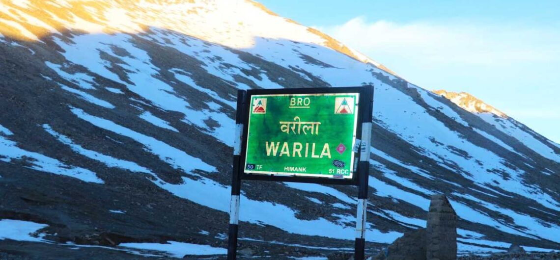
Wari La Pass, one of Ladakh’s most stunning and lesser-known high-altitude passes, sits quietly between two of the region’s most celebrated destinations — Nubra Valley and Pangong Tso Lake. Nestled at an elevation of around 5,312 meters (17,428 feet) above sea level, Wari La is a spectacular route that very few travelers venture on, making it one of the best offbeat attractions for adventure lovers visiting Leh-Ladakh. While Khardung La and Chang La often steal the spotlight, Wari La offers something truly special — a raw, untouched Himalayan landscape, minimal tourist movement, and the thrill of driving on one of the most challenging motorable roads in the world. While a very few tourists take the Wari La route, but it becomes necessity of all the tourists travelling from Nubra Valley to Pangong lake when the main road via Shyok is blocked after landslides and flooding in monsoon and summer season. Location and Connectivity Wari La Pass lies in the Shyok Valley region of Leh district in Ladakh. It connects Sakti village (on the Leh–Chang La route) to Agham village (in Nubra Valley), creating an alternative and shorter route between Nubra Valley and Pangong Lake. However, shortest route passes through Shyok village. The route passes through the remote and beautiful villages of Tangyar, Tirit, and Sakti, offering travelers a glimpse into authentic Ladakhi rural life. It also provides a commanding view of snow-capped peaks, glacial streams, and valleys that change color with every turn. Key Route Map Leh - Karu - Sakti - Wari La - Agham - Shyok - Pangong Tso Hunder/Diskit (Nubra Valley) - Agham - Wari La - Sakti - Chang La - Pangong Lake Leh – Karu – Sakti – Wari La – Tangyar – Agham – Diskit/Nubra Valley Distance: Approximately 160 km from Leh to Diskit
Wari La Pass, one of Ladakh’s most stunning and lesser-known high-altitude passes, sits quietly between two of the region’s most celebrated destinations — Nubra Valley and Pangong Tso Lake. Nestled at an elevation of around 5,312 meters (17,428 feet) above sea level, Wari La is a spectacular route that very few travelers venture on, making
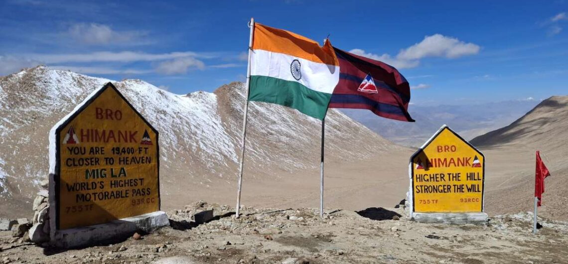
Fukche is a remote location in eastern Ladakh (Nyoma subdivision, Leh district) quite close to the India-China Line of Actual Control (LAC). Historically a military advanced landing ground (ALG), it is gaining attention lately thanks to new road construction and potential for offbeat tourism. If you like border landscapes, remote military-heritage sites, and high-altitude adventure, Fukche is one place to watch. Where is Fukche & Why It’s Important Fukche Advanced Landing Ground is located in the Demchok sector of eastern Ladakh, adjacent to the village of Koyul. The site sits in the Koyul Lungpa river valley, very near where the river meets the Indus (locally called Sengge Zangbo). It is extremely close to the LAC—just 2.5 km away. That means it is of strategic military and geopolitical importance. Initially built before the 1962 Sino-Indian War, it became inactive post-war. It was revived (reopened) by the Indian Air Force in 2008 for military and logistical purposes. Features & Current Status The runway is unpaved/gravel and operates primarily under Indian Air Force control; there are no civilian flight services. Elevation is about 13,700 feet (≈ 4,176 meters) above sea level. There is some local presence (villages like Koyul) nearby, though these are very small and remote. Facilities are very basic or minimal. New Infrastructure & Road Connectivity Fukche is not just about military operations anymore; it is becoming more connected by roads, which may open up possibilities for tourism (if permitted). Key infrastructure projects: Likaru-Mig La-Fukche Road A 64-km long road has connected Likaru to Fukche, passing over Mig La Pass at ~19,400 feet. Road construction done on October 01, 2025, Mig La pass became world’s highest motorable roads. Chushul-Dungti-Fukche-Demchok (CDFD) Road This highway being upgraded to national highway standards with paved shoulders. It runs along the southern bank of the Indus
Fukche is a remote location in eastern Ladakh (Nyoma subdivision, Leh district) quite close to the India-China Line of Actual Control (LAC). Historically a military advanced landing ground (ALG), it is gaining attention lately thanks to new road construction and potential for offbeat tourism. If you like border landscapes, remote military-heritage sites, and high-altitude adventure,
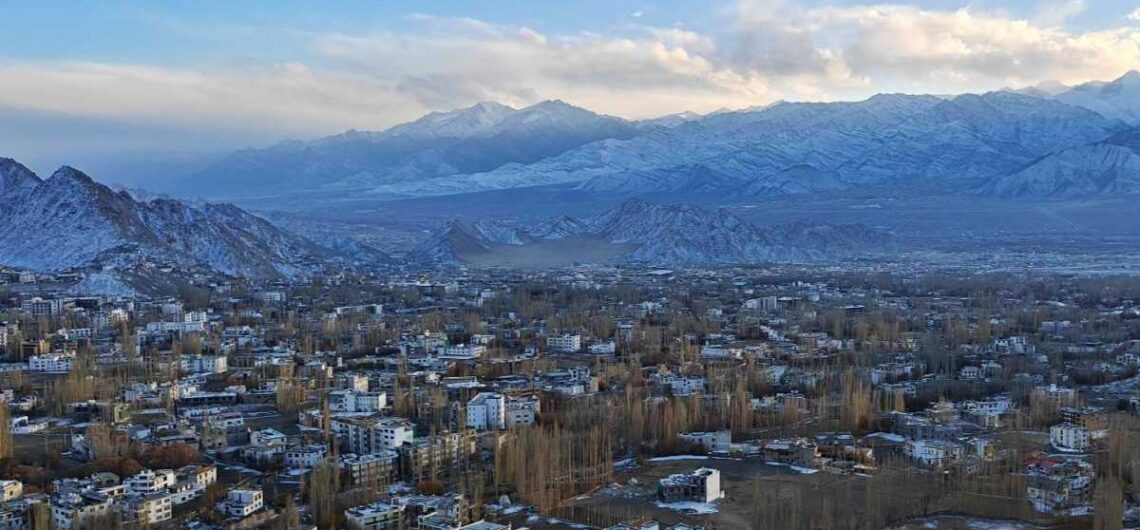
Nestled in the lap of the Himalayas, Leh, the capital of the Union Territory of Ladakh, is a dream destination for travelers from around the world. Perched at an altitude of 11,500 feet (3,500 meters), Leh is more than just a town—it’s an experience of a lifetime. Known for its stunning monasteries, snow-capped peaks, crystal-clear lakes, vibrant local culture, and adventurous terrain, Leh offers something unique to every visitor. Whether you’re an adventure enthusiast, a spiritual seeker, a photographer, or simply someone longing for peace and beauty, Leh in Ladakh is a place that will leave you spellbound. Introduction to Leh – Gateway to Ladakh Leh is located in northern India, bordered by the mighty Karakoram and Zanskar mountain ranges. Once an important stop on the ancient Silk Route, Leh has a rich history of trade and cultural exchange with Tibet, Central Asia, and Kashmir. The region is home to ancient Buddhist monasteries, palaces, and stupas that reflect the deep-rooted Buddhist traditions of Ladakh. Today, Leh serves as the main base for exploring the high-altitude wonders of Ladakh, including Nubra Valley, Pangong Lake, Tso Moriri, and Zanskar Valley. The town is also known for its friendly locals, colorful festivals, and a blend of traditional Ladakhi and modern influences. Geography and Altitude Leh is located at an elevation of around 11,500 feet above sea level, which means the air is thin and oxygen levels are lower than at sea level. For first-time visitors, it’s important to acclimatize properly at Leh town for at least two days before engaging in strenuous activity or heading to higher altitudes. The landscape around Leh is breathtaking—rugged mountains, barren hills, and deep valleys, all under a clear blue sky. Despite being a cold desert, the region enjoys plenty of sunshine during the day, though temperatures can
Nestled in the lap of the Himalayas, Leh, the capital of the Union Territory of Ladakh, is a dream destination for travelers from around the world. Perched at an altitude of 11,500 feet (3,500 meters), Leh is more than just a town—it’s an experience of a lifetime. Known for its stunning monasteries, snow-capped peaks, crystal-clear
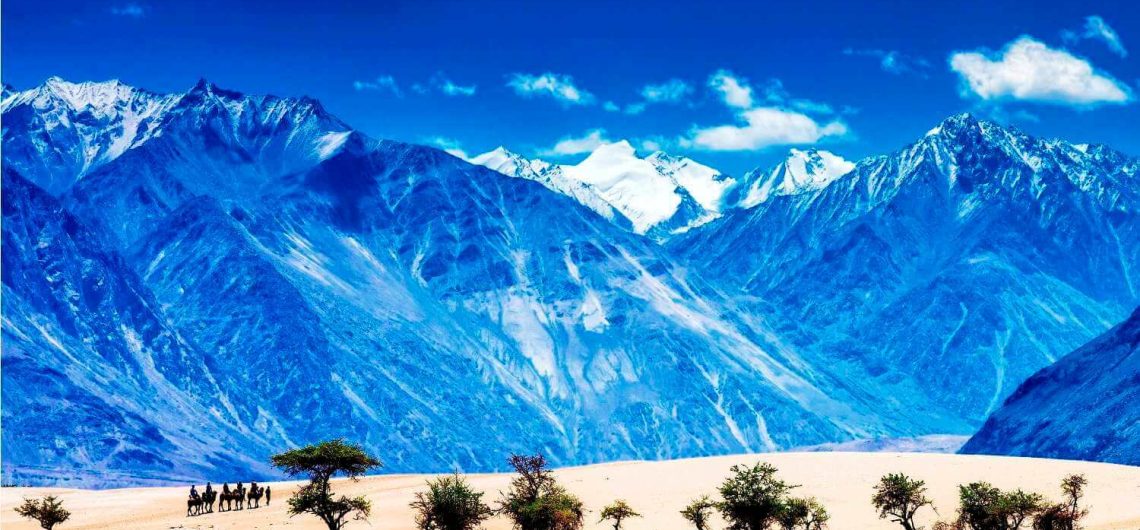
Nubra Valley is in the north of Leh town after traversing 17,982ft high Khardungla pass (Khardongla), which is one of the highest motorable roads in the world. Nubra was earlier known as Ladorma, which means “valley of flowers”. Nubra Valley or Nobra Valley is a famous tourist destination of Ladakh famous for its vast green valleys, sand dunes, double humped camels, beautiful river, monasteries, camping, ATV ride, zipline, and border tourism. Diskit, Hunder, Turtuk, Sumur, Panamik and Siachen Base Camp are the main tourist destinations in Nubra valley. Diskit, Hunder and Sumur are the main settlements of Nubra valley. Diskit is about 130km from Leh. Shyok and Nubra (or Siachen) are the main rivers of the valley. Nubra Valley is comparatively warmer than Leh as the valley is at low altitude. Its vast and plain valleys, sand dunes of Hunder, double humped camels (Bactrian camels) and greenery at many places like oasis in the desert make Nubra must visit place for tourists. Nubra Valley has become a must visit tourist destination of Ladakh and almost all tourists visiting Ladakh would not miss to visit Nubra. Nubra mostly remains connected by road. However, sometimes heavy winter snowfall at Khardungla pass blocks road temporarily. Besides hotels and cottages, tourists prefer staying in tents (camps) in Nubra Valley. However, Nubra Valley has many good hotels, guesthouses and homestays as well. The valley has Buddhist majority. Wheat, peas, mustard, potato, barley, apple, apricot, walnut and almond crops can be seen frequently in the valley. Balti people (both Shia and Sufia) reside at Turtuk in the western end of the valley, close to Indo-Pakistan border. Siachen Glacier, the toughest and highest battlefield of the world lies north of the valley. Diskit monastery (Diskit village) and Samstanling monastery (Sumur village) are the main monasteries of Nubra
Nubra Valley is in the north of Leh town after traversing 17,982ft high Khardungla pass (Khardongla), which is one of the highest motorable roads in the world. Nubra was earlier known as Ladorma, which means “valley of flowers”. Nubra Valley or Nobra Valley is a famous tourist destination of Ladakh famous for its vast green